


























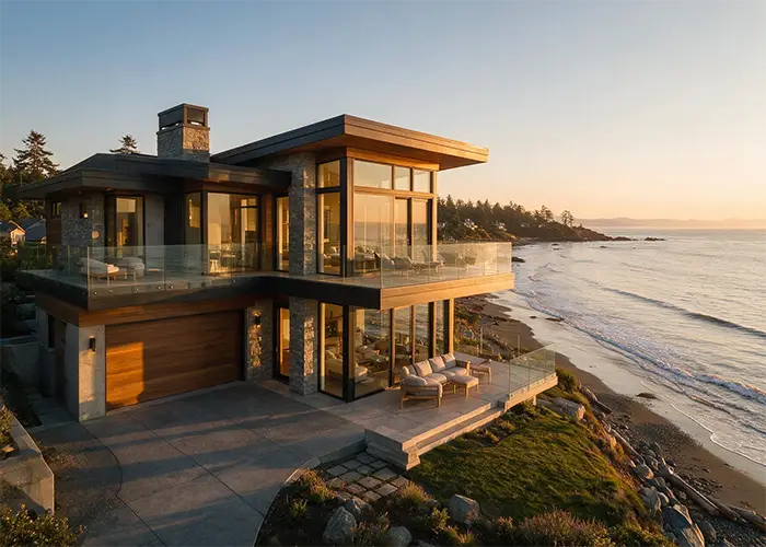
A waterfront lot is one of the most desirable purchases on Vancouver Island, and also one of the most misunderstood from a building standpoint. The view that sells the property is often the same feature that shrinks the buildable envelope once setbacks, environmental review, and geotechnical requirements are factored in. Here’s what to actually check before you fall in love with a waterfront lot.
You Don’t Own the Foreshore
In nearly all cases, the Province of BC owns the foreshore — the area below the natural boundary, generally defined by the naturally occurring high water mark. That boundary isn’t fixed either; it can shift gradually over time as water levels naturally rise or fall. Practically, this means that if you’re planning a dock, retaining wall, or any structure extending toward or over the water, you’ll likely need separate approval from the Province to build on Crown land, on top of your municipal building permit.
Setbacks Are Not a Fixed Number
There’s no single waterfront setback that applies across Vancouver Island. The required distance depends on the type of water feature, the local government’s zoning and Development Permit Areas, and whether the property is subject to the Riparian Areas Protection Regulation. Setbacks on Vancouver Island commonly range from roughly 10 to 30 metres or more, depending on the watercourse and local bylaws — and a large lot can still end up with a surprisingly small buildable area once every overlay is mapped.
One important distinction: the Riparian Areas Protection Regulation applies to freshwater features like streams, lakes, and wetlands, not to marine or estuarine shorelines. Ocean-facing waterfront is instead governed primarily by the federal Fisheries Act and local Coastal Development Permit Areas, which function similarly but through a different regulatory path.
Ask your municipality or regional district: whether the property falls within a riparian or coastal Development Permit Area, and what professional reports will be required before a building permit is issued.
A Qualified Environmental Professional May Be Required
If your lot is near a stream, lake, wetland, or even a seasonal drainage ditch that connects to fish habitat, you may need an assessment from a Qualified Environmental Professional before development can proceed. This report defines the Streamside Protection and Enhancement Area — the buffer zone where construction is restricted — and is one of the most commonly triggered requirements for waterfront and near-water lots across the Capital Regional District and neighbouring regional districts.
Don’t Assume an Existing Home Sets the Rules
Many older waterfront homes and cottages on Vancouver Island were built decades ago, often closer to the water than current setback rules would allow. These structures are typically “grandfathered” and can usually be renovated in place, but new construction on the same lot generally has to meet today’s setback and environmental requirements — which can mean building further back from the water than the original home.
Factor In Slope Stability
Waterfront and water-view lots are more prone to slope instability from erosion or bank failure than typical building sites. A geotechnical assessment is often required as part of the permitting process, and its findings can meaningfully affect where a home can sit on the lot, what foundation type is used, and what erosion protection measures are needed.
Flood Construction Levels and Sea Level Rise
Beyond setbacks, waterfront homes are typically required to meet a minimum flood construction level — the elevation the lowest habitable floor must sit above, based on projected storm surge or flood levels for that specific body of water. Coastal properties increasingly need to factor in provincial sea level rise guidance as well, which can affect both the required elevation and the long-term insurability of the property.
Questions Worth Asking Before You Buy the Lot
- Is this a freshwater or marine waterfront, and which regulatory framework applies?
- Has a survey confirmed the current natural boundary and foreshore line?
- Does the property fall within a riparian or coastal Development Permit Area?
- Has a geotechnical assessment been done, and did it flag any slope stability concerns?
- What is the flood construction level requirement for this specific property?
- Is there an existing structure that’s grandfathered closer to the water than current rules allow?
The Bottom Line
None of this means waterfront building on Vancouver Island isn’t worth it — it clearly is, given how much of the Island’s appeal is tied to the coastline. It does mean the due diligence has to happen before you buy the lot, not after, since the buildable envelope, foundation requirements, and total project cost can all shift significantly once setbacks, environmental assessments, and slope stability are factored in.
Editorial note: This article is intended for general informational purposes only and does not constitute legal, environmental, or engineering advice. Waterfront building requirements — including setbacks, environmental assessments, and permitted uses — vary by property, local government, and regional district, and are subject to change. Before purchasing or building on a waterfront lot, consult your municipality or regional district directly, along with a qualified environmental professional, geotechnical engineer, and/or real estate lawyer to confirm current requirements for your specific property.